Trail Touring skiing Les Orres - Col de l'Âne/Eissalette - Photo
 R@ph
R@ph

User GUIDE

© OpenStreetMap contributors
Length
Length
5.3 km
Max alt
Max alt
2518 m
Uphill gradient
Uphill gradient
840 m
Km-Effort
Km-Effort  
13.7 km
Min alt
Min alt
1671 m
Downhill gradient
Downhill gradient
1 m
Boucle
Boucle
No
Creation date :
2018-04-17 18:20:50.714
Updated on :
2018-07-19 10:03:04.129

(0 Reviews)

Touring skiing
Touring skiing
2h00
Difficulty : Medium

Scan this QR Code to open this trail in the SityTrail application

FREE GPS app for hiking

Logo SityTrail SityTrail

IGN / Geographical institutes

Download SityTrail from the App Store Download SityTrail from Google Play

Logo SityTrail SityTrail World

The world is yours!

Download SityTrail from the App Store Download SityTrail from Google Play Download SityTrail on Huawei AppGallery

About

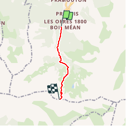
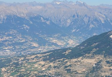
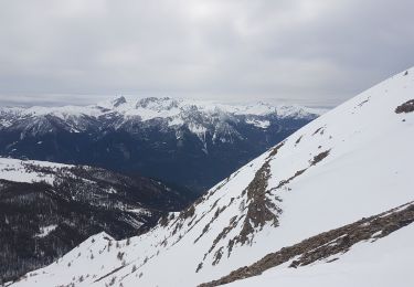
Trail Touring skiing of 5.3 km to be discovered at Provence-Alpes-Côte d'Azur, Hautes-Alpes, Les Orres. This trail is proposed by R@ph.

Description

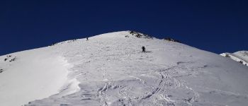
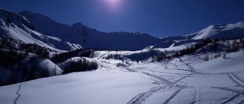
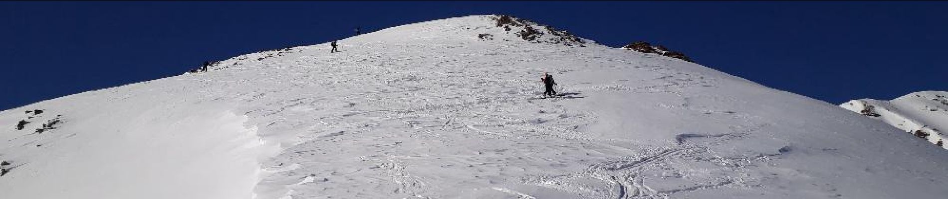
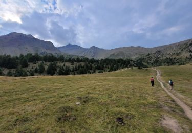
Montée au col de l'Âne/Eissalette en ski de rando sous un soleil radieux,très bonne neige. Le froid -9 et l'absence de vent l'ont bien préservée. De nombreux skieurs dans l'ascension.

Elevation profile

Photos

Points of interest

Point of interest Les Orres - Vue au sommet - Photo
R@ph
LES ORRES 

Positioning

Country:
France
Region :
Provence-Alpes-Côte d'Azur
Department/Province :
Hautes-Alpes
Municipality :
Les Orres
Location:
Unknown
Start:(UTM)
305188 ; 4928503 (32T) N.

Trails nearby

Trail Walking Les Orres - le pic de Boussolenc par la tête du vallon Rémollon - Photo
Walking
GUIDE
amiral13

Walking

Medium
(1)
Les Orres, Provence-Alpes-Côte d'Azur, Hautes-Alpes, France
7.7 km | 13.7 km-effort
4h 50min
Yes
Trail Walking Les Orres - lac de Sainte Marguerite Les Orres - Photo
Walking
guariso

Walking

Medium
(2)
Les Orres, Provence-Alpes-Côte d'Azur, Hautes-Alpes, France
11.1 km | 19 km-effort
4h 25min
Yes
Trail Walking Les Orres - 2012-08-10_Sentier du garde - Photo
Walking
Tchoubi

Walking

Medium
(1)
Les Orres, Provence-Alpes-Côte d'Azur, Hautes-Alpes, France
11.3 km | 17.6 km-effort
4h 6min
Yes
Trail Mountain bike Les Orres - Les Orres 1800 - Savines le Lac - Photo
Mountain bike
tracegps

Mountain bike

Difficult
(1)
Les Orres, Provence-Alpes-Côte d'Azur, Hautes-Alpes, France
28 km | 42 km-effort
3h 0min
No
Trail Walking Les Orres - l'Aupillon - Photo
Walking
GUIDE
amiral13

Walking

Difficult
Les Orres, Provence-Alpes-Côte d'Azur, Hautes-Alpes, France
16.8 km | 33 km-effort
7h 43min
Yes
Trail Walking Les Orres - le Pouzenc - Photo
Walking
GUIDE
amiral13

Walking

Difficult
Les Orres, Provence-Alpes-Côte d'Azur, Hautes-Alpes, France
14.6 km | 31 km-effort
7h 41min
Yes
Trail Snowshoes Les Orres - Lac de Sainte Marguerite. Les ORRES - Photo
Snowshoes
BLANCHET

Snowshoes

Medium
(2)
Les Orres, Provence-Alpes-Côte d'Azur, Hautes-Alpes, France
6.8 km | 13.4 km-effort
3h 26min
No
Trail Touring skiing Les Orres - Col de l'Eissalette, Montagne de la Cabane - Photo
Touring skiing
GUIDE
David25400

Touring skiing

Medium
Les Orres, Provence-Alpes-Côte d'Azur, Hautes-Alpes, France
13.1 km | 27 km-effort
5h 6min
Yes
Trail Touring skiing Les Orres - Col de l'Eissalette - Photo
Touring skiing
GUIDE
David25400

Touring skiing

Easy
Les Orres, Provence-Alpes-Côte d'Azur, Hautes-Alpes, France
11.4 km | 23 km-effort
3h 59min
No


Close
My subscriptions